City of Rocks National Reserve - Idaho

I been wanting to see City of Rocks during Fall Season and finally I did it this year. We drove to the Castle of Rocks then to the City of Rocks. Its my second time in the City of Rocks but first time in the Castle of Rocks. Ohh well I like City of Rocks than the Castle lol, so most of my photos are from the City of Rocks. 


I dont know what im thinking but i only have few photos, I enjoyed the scenery a lot that I forgot to took photos. We enjoy a lot in there, we're like kids climbing bouldering into the rocks lol. 


I love the change of colors, the surroundings were so colorful. Looking at those rocks seems like we're in the other planet lo


The City of Rocks National Reserve, also known as the Silent City of Rocks, is a United States National Reserve and state park lying 2 miles (3.2 km) north of the south central Idaho border with Utah. It is widely known for its excellent rock climbing and rock formations.

The rock spires in the City of Rocks and adjacent Castle Rocks State Park are largely composed of granitic rock of the Oligocene Almo pluton and Archean Green Creek Complex.

The City of Rocks is a popular rock climbing area, with over 1,000[6] traditional and bolt-protected routes. In the 1980s, it was home to some of the most difficult routes in the US, mostly developed by Idaho climber Tony Yaniro.[citation needed] Climbers in the region refer to the area as simply 'The City'.

California Trail wagon trains of the 1840s and 1850s left the Raft River valley and traveled through the area and over Granite Pass into Nevada. Names or initials of emigrants written in axle grease are still visible on Register Rock. Ruts from wagon wheels also can be seen in some of the rocks.

History

Emigrant inscriptions in axle grease on Camp Rock, City of Rocks National Reserve, Idaho.

In 1849, an emigrant party with James Wilkins "encamped at the city of the rocks" on the California Trail just north of the Great Salt Lake Desert. Signatures in axle grease on rock faces can be seen today. One emigrant[who?] saw the distant rocks in August like "water thrown up into the air from numerous artificial hydrants." Beginning in 1843, City of Rocks was a landmark for emigrants on the California Trail and Salt Lake Alternate Trail[7] and later on freight routes and the Kelton, Utah to Boise, Idaho stage route.

The area's historical and geological values, scenery, and opportunities for recreation led to its designation as City of Rocks National Reserve in 1988. This unit of the National Park System is managed cooperatively by the National Park Service and the Idaho Department of Parks and Recreation.

Native American history

The Shoshone and Bannock tribes hunted the buffalo that once roamed in the City of Rocks area and gathered the nuts of the pinyon pine trees. The arrival of horses in the Americas in the 16th century and swelling European immigration disrupted the Shoshone-Bannock homelands and traditional way of life. They grew to resent the intruders but could do little to stop them. Most emigrants on the California Trail saw no Native Americans, but some of their journals record smoke rising from high hills and the surrounding mountains.

In 1826, Peter Skene Ogden and his Snake River brigade of beaver trappers were the first Euro-Americans to note the City of Rocks. Having few beaver, the area was ignored until 1843, when growing streams of wagons began flowing through the area in the summer.

California Trail

City of Rocks National Reserve, Idaho.

After many attempts to find a wagon route to California early California settlers like Joseph B. Chiles and mountain men such as Joseph R. Walker found the route up the Raft River, through the City of Rocks, over Granite Pass and down a series of streams like Goose Creek and Thousand Springs to the Humboldt River. From the junction of the Humboldt near today's Wells, Nevada they could follow the Humboldt west to the Sierra Nevada (U.S.) and on to California. Both Chiles, Walker and later John C. Fremont led settlers over this route. Later wagon parties seldom used guides but followed the tracks of the early pioneer's wagons or the wagons in front of them. By 1850 so many people were on the trail that it was often like a long traveling village crawling its way to California. Newspapers and independent publishers in the east or mid-west often published emigrant "guides" that could be bought for little money from several different authors by 1850. The City of Rocks and the nearby Granite Pass (Idaho) marked roughly half way to California for the emigrants and their loaded wagons.[8] By 1846, some emigrants headed for Oregon's Willamette Valley also used this route as part of the Applegate Trail. This rugged cutoff was little used in later years.

In 1848 Samuel J. Hensley, a pioneer that accompanied Joseph B. Chiles in 1842,[7]:b[9] pioneered the Salt Lake Cutoff from Salt Lake City north of the Great Salt Lake when he traveled east while returning to Missouri. The Salt Lake cutoff rejoined the main California Trail near the City of Rocks.[10] Settlers using the Salt Lake Cutoff traveled about the same number of miles as settlers going by way of Fort Hall and west along the Snake River valley route. In 1852, some 52,000 people passed through the City of Rocks on their way to join the California Gold Rush.

When the California Trail was first opened in 1843, Granite Pass, near City of Rocks provided the pass that allowed an "easy" connection with streams and creeks that provided the needed water and grass for their teams along the way between the Raft River and the Humboldt River. After 1850 the Pass initially became part of Utah Territory,[11] and in 1872 an Idaho-Utah boundary survey error establishing the Utah-Idaho boundary.[8] placed Granite Pass in Idaho Territory. With the completion of the first transcontinental railroad on 9 May 1869, the overland wagon routes began to pass into history. However, wagons and stage lines saw continued use on regional supply routes that spread out from the railroad line to cities not on the railway line(s).

John Halley's stage route connected the railroad (CPRR) station at Kelton, Utah, with Idaho's mining hub of Boise, Idaho, and supplied the early economic development of Idaho, which won statehood in 1890. The Kelton stage route passed through the City of Rocks, with a stage station set up near the junction of the old California Trail and the Salt Lake Cutoff. Settlers began to homestead the City of Rocks area in the late 19th century. Dryland farming declined during the drought years of the 1920s and 1930s, but ranching survived. Livestock grazing began with early wagon use of the area in the mid-19th century and continues today.

One of the favorite camping spots for emigrants was Camp Rock. Emigrants wrote on the stone face with axle grease writing out their names and dates of passage.[12 (From WIKIPEDIA)


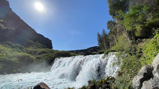
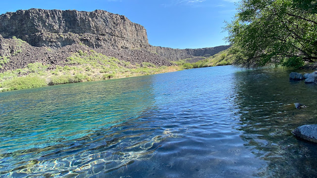
So maybe hopefully next year by Summer we can go and camp in there. Its a great camping spot.

Kathryn Albertsons Park - Boise Idaho

It's the time of the year again, the changing of colors, making the surroundings so colorful. The park i love most in Boise during this time is the Kathryn Albertsons Park. Its so beautiful although this year they have construction going on but beautiful still. When we went there, theres a lot of people doing a photoshoot. Its the perfect place for photos its so picturesque.  


Ohh we did see a deer in the park as well, its like a forest in the city lol. You wouldn't think that this park is in the City area. A lot of trees, flowers, animals etc. I really love this place. It made me relax just watching the scenery. :) 

Sawtooth Wilderness - Stanley Idaho


Its been so boring staying at home for so many weeks, so we decided to go out not in the mall or crowded places but here in this beautiful place. It's an outdoor and not a lot of people, haha of course social distancing still. 

We went to Stanley Idaho mainly in Red Fish Lake.Well we did not do any swimming in the lake because for us its so cold still but there are some people swam in there. We saw a trail for a hike so we went for a hike. 

All i can say is this place is really worth the hike, it's not a hard trail and it's not far either. I love the beautiful scenery, we stayed for a while in here and had a lunch picnic. It was awesome, breathing some fresh air and all you can hear is just the sound of the wind, the water , the birds and some crickets in the surroundings haha.


BOX CANYON - IDAHO

Box Canyon Springs Trail is a 4.3 mile loop trail located near Wendell, Idaho that features a lake and is rated as moderate. The trail is primarily used for hiking, walking, and running and is best used from April until September. Dogs are also able to use this trail but must be kept on leash. There is a $5 entrance fee per vehicle.

Below are the photos i took.


The overlook


The Falls


The water was so clear and inviting, If only it wasnt that iced cold, i would have taken a dip. I wish to go back and have swimming when its not that super cold anymore.

SCOTTISH HIGHLANDS TOURS

We went to Scotland for New Years Eve celebration but before New Years Eve, we went for a two days highlands tour. I swear two days wasn't enough. How we wished we did five days instead of two. There were a lot of places worth exploring for in the highlands. We wanna go back someday. 

These are some of the photos I took with my phone only. I dont have a lot of photos because it was so cold and i dont feel like taking a lot of pictures. My photos dont do the justice of these beautiful sceneries. You should see it yourself :) SCOTLAND IS SO BEAUTIFUL.


Fort Williams


Invermoriston Bridge

Day 1

Head into the Highlands...
Leaving Scotland's capital city Edinburgh behind us we first join with our fellow travellers from Glasgow, Scotland's largest city with a population of approximately 600,000 people. That's over 100,000 more than Edinburgh. The first leg of our journey north takes us in the Loch Lomond and Trossachs National Park to the quaint village of Luss on the western banks of Loch Lomond, best known as a haven for wildlife and stunning flowers, so keep your eyes peeled. You can wander the shore, walk past pretty cottages and do a bit of shopping here if you like.
Experience the Great Glen & Glen Coe...
As we travel further into the Highlands, we visit Glen Coe, one of the most beautiful valleys in the world. Feel the past come to life as your guide tells you about the terrible massacre of the MacDonald clan. We then depart Glen Coe via the Great Glen, another one of Scotland's majestic valleys which stretches 62 miles from Inverness all the way to Fort William
See the UK's highest mountain, Ben Nevis... 
Fort William, the second largest town in the Highlands, lies in the shadow of Ben Nevis. At an impressive 1,345m tall, this is Britain's tallest mountain. Over 100,000 people climb Ben Nevis annually often as part of the 3 Peaks Challenge, making it a very popular mountain! Your driver-guide will decide the best spot for lunch depending on your group, weather and local events. 
Glenfinnan Viaduct and Monument...
Our journey will continue west to Glenfinnan, made famous by the Harry Potter films which feature the iconic Viaduct. In the summer months, you may catch a glimpse of this magical train crossing the Viaduct and you can image Harry, Ron and Hermione on their way to Hogwarts. Glenfinnan is also home to the impressive Glenfinnan Monument. Surrounded by spectacular Highland scenery at the head of Loch Shiel, the monument is a striking tribute to those who fought in the Jacobite Risings.
Overnight: Near Loch Ness

Day 2

 Go Monster Hunting on Loch Ness...
After a delicious Scottish breakfast, you have time to explore the Loch Ness, Britain's largest body of water by volume. More impressive is the fact that all lakes and rivers of England and Wales could fit in with room to spare! The size and depth of the loch make it a perfect hiding place for Nessie, the famous monster. Why not take a boat tour* from Urquhart Castle*, a ruined castle perched on the edge of Loch Ness or monster hunt from the shore?
Through Inverness to Culloden Battlefield...
We then drive through Inverness, the capital of the Highlands to visit Culloden*, last stand of the Jacobites against the British government forces. With estimated casualties between 1,500 and 2,000 from a battle that lasted less than 1 hour, it was one of the quickest and bloodiest battles in Scottish history and it changed the Scottish Highlands forever. A visit to the battlefield is a poignant experience, you can walk the earth where the battle took place and see the headstones that mark the graves of hundreds of clansmen who gave their lives for the Jacobite cause.
The Cairngorm National Park and a Highland Whisky...
Then we'll travel south and enjoy the stunning scenery as we pass through the unique wilderness of the  Cairngorms, Scotland's largest National Park. Its mountain range has five of the UK's highest mountains within its limits. Venturing further south through the Highlands, we'll stop for a visit at one of Scotland's many distilleries. You'll   discover   how whisky is produced and try a dram of our national drink.
Homeward Bound...
Before returning to Scotland's capital Edinburgh, we will make one last stop at a beautiful Highland town, chosen by your driver-guide. (By highland experience tours)

For more info please visit Highland Experience Tours. It was such a fun and memorable experience. Our tour guide? he's awesome :)

Lake Mcdonald - Glacier National Park

I was a lil bit sad when we visited this lake because the weather that time wasnt good. It was gloomy and its raining a lot. Taking photo is so hard, i need sun so the color will be vibrant hehe. Still we tried to enjoy the visit. This lake is so beautiful, if only its summer i would definitely go for a dip and enjoy but haha it was freezing cold. Here's some of the photos i took. 
Lake Mcdonald 


This last photo has a lil bit of a sunshine, its right before we leave the sun shine just a lil bit. :) 

Lake McDonald is the largest lake in Glacier National Park. It is located at 48°35′N 113°55′W in Flathead County in the U.S. state of Montana. Lake McDonald is approximately 10 miles (16 km) long, and over a mile (1.6 km) wide and 472 feet (130 m) deep, filling a valley formed by a combination of erosion and glacial activity. Lake McDonald lies at an elevation of 3,153 feet (961 m) and is on the west side of the Continental Divide. The Going-to-the-Sun Road parallels the lake along its southern shoreline. The surface area of the lake is 6,823 acres (27.6 km2).
The lake is home to numerous native species of trout, and other game fish. Catchable species include, but are not limited to - westslope cutthroat troutrainbow troutbull trout (char), lake trout (char), Lake Superior whitefish, mountain whitefish, kokanee salmon (landlocked sockeye), and suckers. However, the lake is nutrient-poor and is not considered a prime fishing destination. Grizzly bearsblack bearmoose, and mule deer are found in many places near the lake but are most common on the north shore. The lake is surrounded by a dense coniferous forest dominated by various species of sprucefir, and larch.
At the westernmost section of the lake in Apgar there is a National Park Service visitor center with limited lodging and dining facilities. Lake McDonald Lodge is the largest lodging facility on the lake and is approximately 5 miles (8.0 km) east along the Going-to-the-Sun Road. The lodge was constructed in 1913-14 to resemble a rustic hunting lodge with Swiss-influenced architecture.
McDonald Creek flows into and drains from the lake, and empties into the Middle Fork Flathead River shortly after. (Wiki)

Featured Post

City of Rocks National Reserve - Idaho

I been wanting to see City of Rocks during Fall Season and finally I did it this year. We drove to the Castle of Rocks then to the City of R...